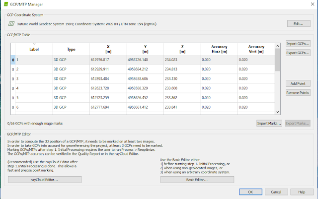
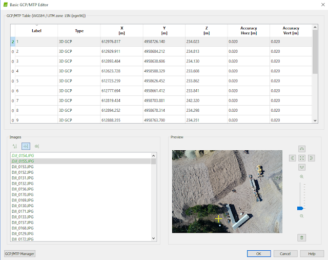
This project introduces the user to manually tying Ground Control Points (GCP's) to UAS imagery in Pix4D. It is virtually the same as the previous 'Processing Data with Pix4D' lab with the exception of manually adding ground control points. The ground control points in this lab were physically placed at the site of the imagery before it was flown. These ground control points were then recorded by using survey grade GPS units. This location information of the GCP's will be used to tie the imagery down to the real world. The last lab had issues with the images not having the correct elevation. Hopefully, adding the GCP information to the images will solve this issue.
Methods:
The method to add pictures and process them is the same process as the 'Processing Data with Pix4D' lab except for one step before the processing is actually started. When the user gets to the main Pix4D screen, they want to go to Project - GCP/MTP Manager- and import their GCP coordinates from a text file. This text file contains location, elevation, and accuracy information about the GCP's.
If the re-optimization is done and the GCP's are all marked it is time to run the rest of the processing to get a point cloud and a DSM. This is done the same was as it was done in the last lab.
GCP's and Data Quality:
In the previous lab, the same imagery was processed without using GCP's. This resulted in bad data that could not be used. Pix4D automatically generates GCP's from the image data to tie the images to a location on earth. To the untrained professional this may be enough. Manually placing GCP's at a project site and taking their location with a highly accurate GPS allows for the user to input these into Pix4D and tie them to the imagery. This creates maps that are highly accurate and spatially tied to the real world. Highly accurate imagery and maps is highly valuable in many situations.
Maps:
Conclusions:
In order to get highly accurate positional data from UAS data, GCP's must be incorporated especially if a local datum is not available. If taking flights in a remote country or location GCP's may be the only option to tying the images to the earth. The use of GCP's create more accurate data that is highly beneficial to the user in the long run. This data is spatially correct and can be used for volumetrics of piles in the mine. Volumetrics can be done using ArcMap and if done correctly can get as accurate, if not more accurate numbers than using a total station or doing it the traditional way of climbing piles and measuring. GCP's are extremely important for accurate data and should be used every time a site is flown. This ensures accurate data and accurate data is vital for good analysis.


No comments:
Post a Comment